
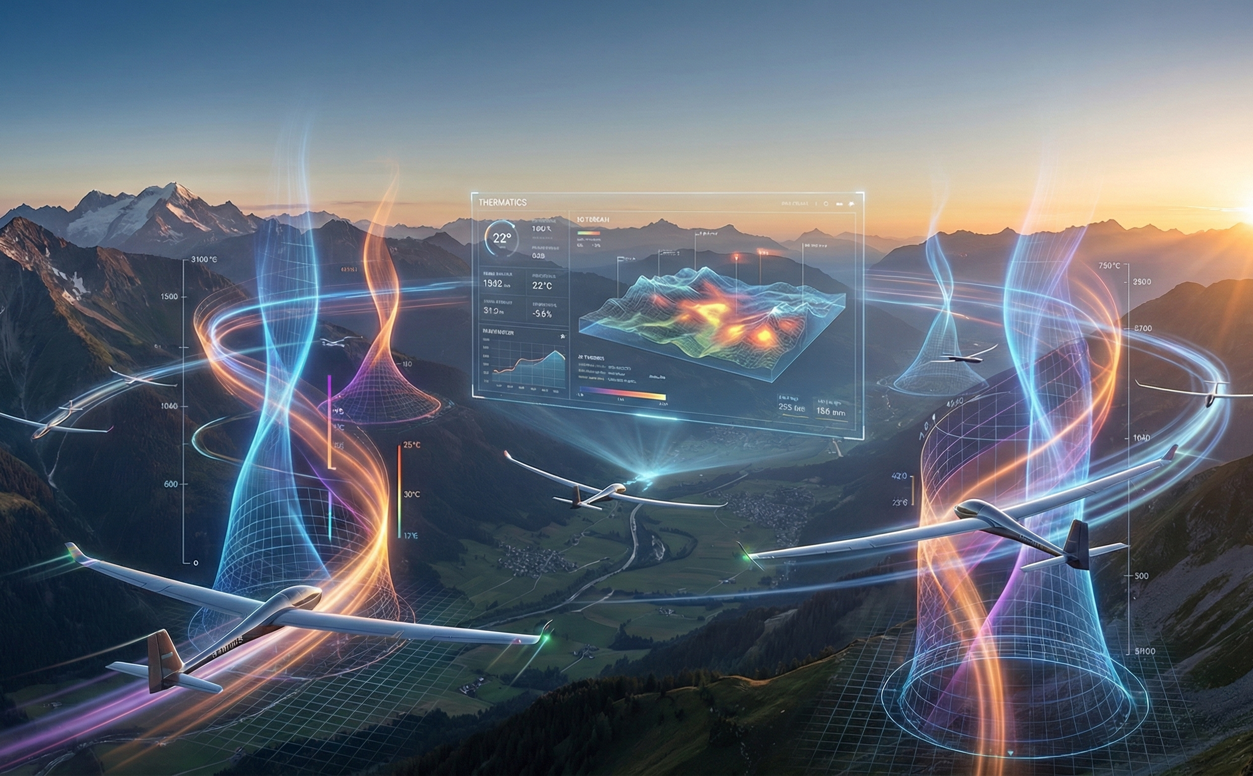
Decoding the Invisible Sky
Thermatics transforms invisible atmospheric energy into actionable assets. We are building the navigation layer for the lower sky—a unified platform that powers infinite-endurance drones, predictive flight instruments, and high-fidelity backcountry safety tools.
The Science of Thermal Intelligence
Bridging the Data Gap
Current meteorological models (like GFS or ECMWF) are excellent at predicting macro-scale events but fail at the micro-scale. They cannot tell where the micro-phenomena that feeds the atmosphere happens.
This "Data Gap" does more than limit flight endurance; it blinds us to the genesis of weather itself. By digitizing the unseen forces of the Planetary Boundary Layer, Thermatics doesn't just guess weather—we unlock a new layer of precision for predicting wind shifts, precipitation, and severe weather events.

Simulating the Physics of the Sky
We go beyond historical averages. Our proprietary model fuses high-resolution topography with real-time atmospheric data to calculate surface heating, moisture convection, and air parcel buoyancy.

Ingest: DEMs, Solar Radiation, & Soil Moisture.
-
Process: 4D mapping of vertical velocity & humidity.
-
Validate: Real-time confirmation via autonomous gliders.